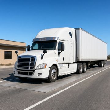
Truck Stop, Rest Area and Weigh Station Map
Find truck stops, rest areas and weigh stations on a satellite map with city and state labels, or switch to a street map. Pick a state or zoom in to load its locations, and tap a pin for the name, road and source. Every state also has a plain list that works on any phone.
Check before you go. The map may be incomplete or out of date. Locations come from OpenStreetMap volunteers, a federal truck parking survey and state agency weigh station lists, not from live feeds, so the map does not show whether a weigh station or rest area is open or closed, or how many parking spaces are free. Always obey posted signs and check the state DOT or 511 service for closures.
6,922 locations in 50 states: 3,221 truck stops, 2,955 rest areas and service plazas, and 746 weigh stations.
Pick a state below to see its full list.
The map needs JavaScript. Every location is listed on the state pages below.
Satellite view: Imagery and labels from USGS The National Map (Imagery Topo, public domain). Street view: Map data © OpenStreetMap contributors. Locations: © OpenStreetMap contributors under the Open Database License, the FHWA truck parking survey (public domain), and weigh station lists from state agencies and the Utah state GIS office (listed under Sources and licences, some used only as a name check). See a mistake? Report a map issue.
Open or closed is not shown. The map may be incomplete. It does not show whether a weigh station or rest area is open, or free parking spaces. Obey posted signs and check the state DOT or 511 for closures.
Sources and licences
- OpenStreetMap
- Licence: Open Database License (ODbL) 1.0. Data as of 2026-10-23, retrieved 2026-10-24. Credit: (c) OpenStreetMap contributors.
- FHWA Jason's Law Truck Parking Survey (BTS NTAD Truck Stop Parking)
- Licence: Public domain (work of the US government, 17 U.S.C. 105); NTAD says available for unrestricted public use. Data as of 2019-04-09 (compiled), layer last edited 2024-06-26, retrieved 2026-10-24. Credit: U.S. DOT, Bureau of Transportation Statistics, National Transportation Atlas Database.
- Official state weigh station lists (names and coordinates)
- Weigh stations in these states are checked against the state agency list; the official name and position are used where they match, the list adds stations missing from the map, and pins the list does not include are marked as not on the list.
- Alaska: Alaska Department of Transportation and Public Facilities, AKDOT Weight Scales. Terms: No licence stated on the public ArcGIS item (AKDOT_APEX). Public government layer, no use restriction stated. Retrieved 2026-10-24.
- Arizona: Arizona Department of Transportation, Port of Entries. Terms: Item terms: provided as is, no warranty; users make their own assessment. No use restriction stated. Retrieved 2026-10-24.
- California: California Department of Transportation (Caltrans), Commercial Vehicle Enforcement Facilities. Terms: Item terms: 'This application is available to the public.' Caltrans layer, no use restriction stated. Retrieved 2026-10-24.
- Colorado: Colorado Department of Transportation, Port of Entry Locations. Terms: Item terms: State of Colorado Terms of Service Policy (no use restriction for public data stated). Retrieved 2026-10-24.
- Florida: Florida Department of Transportation, Motor Carrier Size and Weight, Motor Carrier Size and Weight - Weigh Station Information. Terms: Item terms: provided as is, as available, no warranty, no liability. No use restriction stated. Retrieved 2026-10-24.
- Iowa: Iowa Department of Transportation, Weigh Scale. Licence: Creative Commons Attribution 4.0 International, plus Iowa DOT GIS data terms of use. Retrieved 2026-10-24.
- Idaho: Idaho Transportation Department, Ports of Entry. Terms: Item terms: ITD spatial data disclaimer (as is, no warranty); credit ITD as the original source. Retrieved 2026-10-24.
- Illinois: Illinois Department of Transportation, IDOT Weigh Stations. Terms: No licence stated on the public ArcGIS item. Public government layer, no use restriction stated. Retrieved 2026-10-24.
- Indiana: Indiana Department of Transportation, INDOT Facilities - Weigh Station. Terms: No licence or terms stated on the public INDOT map service. Retrieved 2026-10-24.
- Louisiana: Louisiana Department of Transportation and Development, Weigh Stations. Terms: Item terms: 'There are no use limitations ... The data is provided free to use in any product or publication', no warranty. Retrieved 2026-10-24.
- Minnesota: Minnesota Department of Transportation, MnDOT Weigh Stations. Terms: No licence stated on the public ArcGIS item (MnDOT staff account, 2019). Retrieved 2026-10-24.
- Montana: Montana Department of Transportation, Motor Carrier Services, Motor Carrier Services Scale Sites. Terms: Item terms: provided as is, no warranty, MDT not liable. No use restriction stated. Retrieved 2026-10-24.
- New Mexico: New Mexico Department of Transportation, Ports of Entry. Terms: Item terms: NMDOT notice of disclaimer (no warranty). No use restriction stated. Retrieved 2026-10-24.
- Oregon: Oregon Department of Transportation, Weigh Stations (TransGIS basemap overlay). Terms: ODOT GIS data page: GIS data offered for download without restriction; no warranty. Retrieved 2026-10-24.
- Utah: Utah Geospatial Resource Center (state GIS office), Utah Ports Of Entry. Licence: Creative Commons Attribution 4.0 International (CC BY 4.0), with the UGRC as-is disclaimer. Credit: Utah Ports Of Entry, Utah Geospatial Resource Center (state GIS office), licensed under CC BY 4.0. Retrieved 2026-10-24.
- Wisconsin: Wisconsin Department of Transportation and Wisconsin State Patrol, Safety and Weight Enforcement Facilities (SWEFs). Terms: No licence stated on the public ArcGIS item. Public WisDOT layer, no use restriction stated. Retrieved 2026-10-24.
- State lists used as a name check only
- These lists are used only to confirm and name weigh stations already on the map. Positions come from OpenStreetMap or the federal survey, and no points are added from these lists.
- Kansas: Kansas Highway Patrol, Weigh Stations (web page list, no coordinates). Terms: Public web page of the Kansas Highway Patrol. Names and road descriptions only, no coordinates; used only to confirm and name existing points by hand. Retrieved 2026-10-24.
- Maryland: Maryland Department of Transportation State Highway Administration, SHA Truck Weigh Inspection Stations 2009. Terms: Item terms: 'Open to Public.' Data dated 2009, last updated 2011, so used only to confirm existing points. Retrieved 2026-10-24.
- North Carolina: North Carolina Department of Transportation, Weigh Stations Feature Layer. Terms: Item terms: NCDOT not liable for errors; not a legal document; verify with primary sources. The item text says the application is for NCDOT staff and business partners, but the layer is shared publicly. Retrieved 2026-10-24.
- Oklahoma: Oklahoma Department of Transportation, Ports of Entry and Weigh Stations. Terms: Item terms: 'Authorized reference use only.' Shared publicly by ODOT GIS Management Branch. Retrieved 2026-10-24.
The location files behind this map (/truckmap/*.json) are a derived database of OpenStreetMap data, combined with the public survey and state lists above, and are made available under the Open Database License 1.0.
Get Big Rig Daily free every morning
The trucking stories drivers are talking about, in one short email. Free. Unsubscribe any time.
How to use the truck stop map
Pick a state from the list, or zoom in on the map, and that state's truck stops, rest areas and weigh stations appear as colored pins. Blue pins are truck stops, green pins are rest areas and service plazas, and orange pins are weigh stations. Use the check boxes to show only one type. Tap a pin to see the name, the road or brand where we have it, the source of the record and a link to view the spot on OpenStreetMap.
The map opens in satellite view with city and state names on top. Use the layer button in the corner of the map to switch to a street map. If the map does not load, or you have JavaScript turned off, use the state lists. Each state has its own page with every location in plain text and a map link for each one.
Get Big Rig Daily free every morning
The trucking stories drivers are talking about, in one short email. Free. Unsubscribe any time.
Where the locations come from
Truck stops come from OpenStreetMap. We include fuel stations and highway service sites that volunteers have tagged for trucks, such as places marked for heavy goods vehicles or truck diesel, places named as travel centers, travel plazas or truck stops, and places tagged with a truck stop brand. Weigh stations come from OpenStreetMap vehicle scales and inspection sites next to major highways, from the Federal Highway Administration truck parking survey, and from weigh station and port of entry lists published by state transportation departments, state patrols and the Utah state GIS office. Lists from 16 states supply names and positions; the Oklahoma, North Carolina, Maryland and Kansas lists are used only as a name check. Rest areas and service plazas come from OpenStreetMap and the same survey, which was done for Jason's Law and is published by the Bureau of Transportation Statistics.
Where the survey and OpenStreetMap list the same place, the map shows it once and keeps the survey's road, mile post and truck space count. Where a state list and the map show the same weigh station, the map uses the state's name and position. In Oklahoma, North Carolina, Maryland and Kansas the state list is used only as a name check: it confirms and names weigh stations already on the map, the position stays as mapped, and no points are added from it. Where a state list is complete, a weigh station pin that the list does not include stays on the map as a hollow gray marker with a note that it is not on the state list, because it may be closed, private, temporary or mapped in error. Big Rig Daily does not add, rate or move locations by hand. The one exception is Kansas, where the Highway Patrol lists its stations by name and road without coordinates, so we matched those names to points already on the map and added no new points. Names are shown as they appear in the source, in plain letters, and a place with no name in the source is shown as unnamed. A truck stop on the map is not an endorsement, and some locations may have closed since they were mapped.
Frequently Asked Questions
Does the map show if a weigh station is open?
No. The map shows where weigh stations are, not whether they are open. There is no official nationwide open or closed feed, so we do not guess. Follow the signs posted ahead of each station, and check the state DOT or 511 service for closures.
Where does the truck stop and weigh station data come from?
Truck stops, most weigh stations and most rest areas come from OpenStreetMap, the free map built by volunteers, under the Open Database License. Public rest areas, parking areas and some weigh stations also come from the Federal Highway Administration truck parking survey for Jason's Law, published by the Bureau of Transportation Statistics. Weigh stations in 16 states are checked against the official state list for names and positions, and in 4 more states (Oklahoma, North Carolina, Maryland and Kansas) the state list is used as a name check only. Utah's list is from the Utah Geospatial Resource Center (state GIS office) under the Creative Commons Attribution 4.0 licence. The sources section on this page links each state agency's list and its terms. Each pin and list entry names its source.
Why is a truck stop missing or in the wrong spot?
OpenStreetMap is built by volunteers, so some places are missing, mapped in the wrong spot or no longer open. You can fix a mistake for everyone at openstreetmap.org/fixthemap, or email [email protected] and we will look at it when we refresh the data.
Are the truck parking space counts current?
The truck space counts come from the federal truck parking survey and can be several years old. They show how many spaces a rest area had when it was surveyed, not how many are open now. Check posted signs and the state DOT for current rest area rules, time limits and closures.
Are public truck scales at truck stops on the map?
No. Pay scales at truck stops, such as CAT Scales, are not state weigh stations, so we leave them out of the weigh station layer. The truck stop itself may still be on the map.
Do I need an app to use the map?
Yes. It is a web page, so it works in any phone browser with no sign-up and no download. The map loads only when you scroll to it, and it loads one state at a time to stay fast. The state lists work even with a weak signal.
Link to this truck stop map
Run a trucking site, school or company page? You are welcome to link to this free tool. Copy the link or the HTML below.
Get Big Rig Daily free every morning
The trucking stories drivers are talking about, in one short email. Free. Unsubscribe any time.
More from Big Rig Daily
- Trucking Pay Per Mile Calculator
- Hours of Service Break Calculator
- Truck Fuel Cost Calculator
- Truck Weight and Axle Calculator
- Free CDL Practice Test: General Knowledge
- Trucking Companies Hiring: Directory and Map
- Owner-Operator Profit Calculator
- Load Rate Checker
- IFTA Fuel Tax Calculator
- Truck Laws by State: Speed Limits, Chain Laws and Idling Rules